
Flight Display Systems FD200CPU Moving Map
 |
Two Versions Available |
||
| FD200CPU-7: | RS-232 Input |
||
| FD200CPU-8: | ARINC 429 Input | ||
- Overview
- Specifications
- Features and Options
- Moving Map Image
- Moving Map and Displays Video
Description
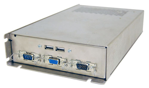
The FD200CPU uses computer generated satellite imagery to display an accurate replication of the Earth’s surface. Included are worldwide databases of cities, borders, airports, and other landmarks to enhance the visual effects. The FD200CPU reads data from other avionic systems onboard, and replicates this data onto the map in real-time. This allows passengers to see the exact position of the aircraft anywhere in the world. Also, the FD200CPU displays air data including speed, altitude, time of arrival, and more.
Flight Display Systems has taken advantage of the latest computer technology, and designed the FD200CPU to be the smallest and lightest Moving Map system available in the aviation industry. The FD200CPU-7/-8 uses a solid state flash memory hard drive that holds the Microsoft Windows XP Embedded operating system, the Moving Map program, worldwide imagery and databases. Flash memory and solid state circuit boards allow the FD200CPU to operate smoothly at extreme temperatures, and increases tolerance for vibration and shock.
System Specifications

Ground Pages
The 3 ground pages can be custom made by the user. They will show up during boarding and taxi and will stop showing once the aircraft reaches 100kts, or they can be set to stay on during flight. Typically these pages will contain company logos, cabin briefings, or welcome aboard messages. The images must be in 1024x768 Windows Bitmap format. Flight Display Systems will format these pages for you at no charge.
Airport Diagrams
The Airport Diagram page shows a chart of the airport, and location of the aircraft. Over 600 airports are in the database, and can be turned on or off.
Vector Maps
The first pages in the cycle are the Vector Maps. You have the option of showing 1, 2, or 3 different zoom levels. All map sizes are customizable by the user. The time to show each zoom is also customizable. By default, levels are set at 2500, 500, and 50 miles. (300, 30, and 3 miles for the Helicopter versions)
Data Pages
The 1st data page shows altitude, speed, distance to go, estimated time enroute, and current time. The 2nd data page shows distance traveled, time in flight, outside air temperature, destination airport, and estimated time of arrival. The second data page can be turned off, or both pages can be turned off to show the data bar ticker at the bottom of the Vector map pages. Colors, times to show, and languages can all be customized.
Additional Data Screens
3 new data screens have recently been added. The first is the Graphic Statistics page, or “dashboard”. This page shows speed, heading, and altitude in a graphics format. The second is the world clocks page which shows local times from at any 6 places you choose (customizable). The third page is the Relative Locator that points to the nearest large cities in relation to the aircraft’s heading.
Satellite Maps
Another recent upgrade is the addition of NASA satellite imagery to the FD200CPU. Like the Vector Maps, there are 3 customizable zoom levels. By default, levels are set at 3500, 600, and 100 miles (1000, 350, and 100 for helicopter versions).
All features of the FD200CPU can be setup to meet any customer’s specifications. We now offer free pre-configuration of Moving Maps before they ship for easy plug and play installation. The pre-configuration form can be downloaded from our website. If you have any questions please contact our customer support staff at 678-867-6717.
Weather Upgrade
As an option, the Flight Display Moving Map can show XM NexRad data. This requires having an antenna, data receiver, and an Aviator Lite subscription from XM. If the aircraft uses XM data for any existing services, such as XM radio or weather in the cockpit, then an additional antenna is not required.
A dedicated* XM data receiver must be used to interface with the FD200CPU-7/-8. The system has been tested and works with the following three models of receivers:
- WxWorx Portable Receiver
- Heads-Up XMD-075*
- Heads-Up XMD-076**
*Requires additional Heads-Up part # XMDPRT-01.
**Not compatible with an optional altitude serializer. (As used on installations such as with a KLN, Garmin using 429, etc.)
Call FDS for more information.
Your Moving Map can guide you on your
trip and welcome you aboard!