
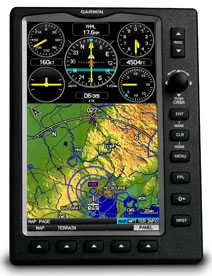
Garmin aera 695 Portable GPS
 |
|||
| Part Number: | 010-00667-50 |
||
Suggested Retail Price: |
$ 1,699.00 |
||
Our Price: |
$ 1,499.00 |
||
Premier Avionics is an Garmin GTN650 and G600 Demo Dealer
- Overview
- Specifications
- In the Box
- Accessories
- aera 696 Video
With features that focus on aviation-only navigation and mapping, GPSMAP 695 is Garmin’s ultimate portable MFD. Similar to the 696, the GPSMAP 695 comes with a large screen and detailed electronic charts — minus XM compatibility — at a price you’ll love.
See the Big Picture
The GPSMAP 695’s bright 7" diagonal high-definition sunlight-readable display makes detailed mapping easy to see day or night — you can even view an entire approach plate on the large-format display. For easy operation, the bezel around the screen includes soft keys and a joystick control. And the internal GPS provides position updates five times per second (5 Hz), allowing the 695 to present flight data smoothly and continuously.
No Chart? No Problem.
With the addition of IFR map mode, Garmin FliteCharts® and ChartView™, the GPSMAP 695 provides key functions of a Class 1/Class 2 electronic flight bag (EFB), reducing the use of paper charts in the cockpit. When in IFR map mode, the 695 can display victor airways, jet routes, minimum enroute altitudes and leg distance, much like what’s found on traditional enroute charts. With FliteCharts, you can quickly find and view all U.S. AeroNav Services, standard terminal arrival routes (STARs), approach charts and airport diagrams. A geo-referenced version of FliteCharts will be available in late 2010, which will provide you with an on-screen representation of your aircraft’s exact position overlaid directly onto these charts. For pilots who prefer Jeppesen charts and diagrams, Garmin also offers ChartView. The ChartView service utilizes Jeppesen’s extensive library to provide global geo-referenced charting capabilities (Chartview activation instructions).
Enhance Situational Awareness
The GPSMAP 695 features a high-resolution terrain page showing hazards relative to your altitude and a vertical profile of terrain along your route of flight. It comes with a built-in Jeppesen database, and an Americas, Atlantic or Pacific terrain database. It also includes an obstacles database for the U.S. or Europe. Using this information, the 695 displays your flight route over contour terrain mapping. With information from the terrain and obstacles databases, the 695 monitors your current position in relation to surrounding terrain to provide alerts. To help keep pilots aware of special airspace activity, over 683 parachute drop zones are detailed in the Americas navigation database. You can even customize your own minimum clearance levels to receive terrain cautions. The 695 also comes with a realistic “view from space” satellite imagery basemap.
Like other portable Garmin devices, the 695 includes the following enhanced aviation databases:
- Garmin SafeTaxi®
Provides detailed taxiway diagrams and position information many U.S., European or Canadian airports. Preloaded on the device, this information helps you navigate unfamiliar airports with confidence and shows your aircraft’s exact position on the field.
- AOPA Airport Directory
Offers detailed information for more than 5,300 U.S. airports, along with the names and phone numbers of thousands of FBOs. Easily look up taxi services, plan an overnight, and choose fuel stops, plus find ground transportation, lodging, restaurants, local attractions and more.
- Private Airports and Heliports
Provides data on private airports and heliports throughout U.S. and Europe, and materially expands your list of navigation and emergency "nearest" options.
Receive Altitude-Sensitive Alerts
When in the air, Garmin’s new Smart Airspace™ feature makes it easier than ever to identify what airspace lies ahead. Smart Airspace automatically highlights airspace close to your current altitude and de-emphasizes airspace away from the current altitude, which gives you increased situational awareness.
Expand Your Portable
The GPSMAP 695 includes an SD™ card slot for extra memory and updates. Keep track of the databases on your GPSMAP 695 through www.fly.garmin.com, our online manager that helps you update, manage and purchase the latest aviation data for your Garmin device, all in one place.
Master the Basics with eLearning
To gain quick familiarity with all the features and operation of your GPSMAP 695, Garmin offers a fully interactive, computer-based training program. It’s called the eLearning Program, and it’s a self-paced, Windows® compatible application developed in conjunction with Pegasus Interactive to help new users take advantage of all the capabilities their GPS unit offers. The software is available in lifetime or lower-cost subscription licenses and is available from authorized Garmin dealers or directly from flyGarmin.com. The eLearning program for your GPSMAP 695 lets you select specific topics of interest, and then learn by doing. A scenario-based guided simulation system helps you practice the selected task or process by following step-by-step, on-screen prompts. You’ll see a simulated multi-media demonstration; then repeat what you’ve learned, hands-on, to reinforce and assess your skills. Getting started with Garmin eLearning is the fast, fun way to master your new portable GPS.
![]()
![]()
![]()
What's in the Box:
- GPSMAP 695
- Free single database update
- Free trial FliteCharts® subscription certificate
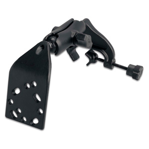
- Yoke mount
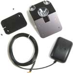
- GA 25 remote antenna with suction cup mount
- 12/24 volt power cable
- AC power adapter
- USB cable
- MapSource® Trip & Waypoint Manager
- Protective cover
- Owner’s manual
- Quick reference guide
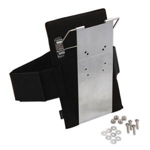
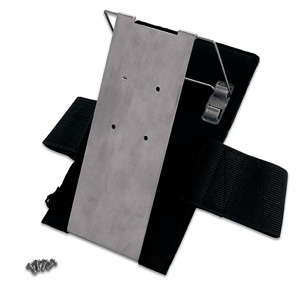
Select an item below to expand the menu and show options.
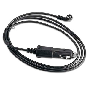 |
12/24 Volt Charging Cable | 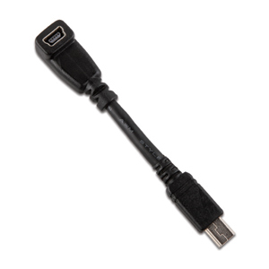 |
USB Adapter |
| 010-11206-13 | 010-11367-00 | ||
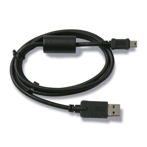 |
Mini USB Cable | 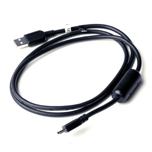 |
Mini USB Cable |
| 010-10723-15 | 010-10723-01 | ||
 |
Power/Data Cable (bare wires) | ||
| 010-11206-15 | |||
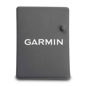 |
Protective Cover | 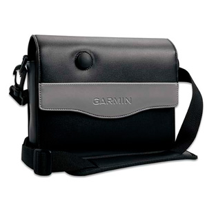 |
Carrying Case |
| 010-11206-14 | 010-11206-01 | ||
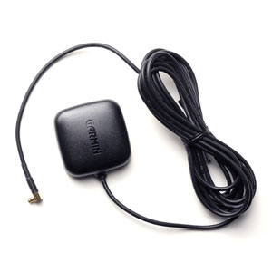 |
GA25MCX Remote Ant. (Low Profile) | 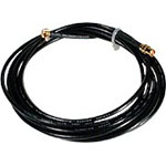 |
EXT. Cable for GA27 Antenna |
| 010-10702-00 | 010-10157-00 | ||
 |
GA27C Auto Antenna (Low Profile) | 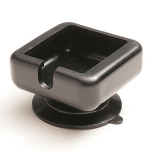 |
Suction Cup Mount for GA25 Ant. |
| 010-10052-05 | 010-10871-00 | ||
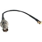 |
Adapter Cable (MCX to BNC) | ||
| 010-10121-00 | |||
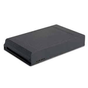 |
Battery Pack Replacement | ||
| 010-11206-10 | |||